


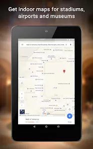


Google Maps is a powerful mapping service developed by Google that provides a variety of features to help users navigate, explore, and discover locations across the globe. Launched in 2005, it has become one of the most widely used tools for navigation, route planning, and location discovery. Google Maps uses GPS technology to offer real-time navigation, turn-by-turn directions, traffic updates, and information about nearby places such as restaurants, hotels, and businesses. Additionally, it offers satellite imagery, street views, and even 3D views of cities to provide an immersive and accurate experience. Google Maps is available on both mobile devices and desktops, making it an indispensable tool for travelers, commuters, and anyone in need of detailed mapping services.
Pros of Google Maps
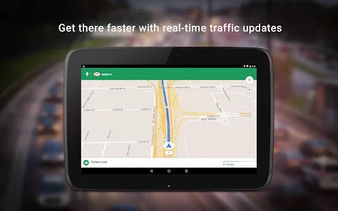
Accurate Navigation: Google Maps provides highly accurate and reliable navigation with real-time traffic updates, rerouting options, and precise directions for driving, walking, and public transportation.
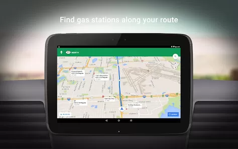
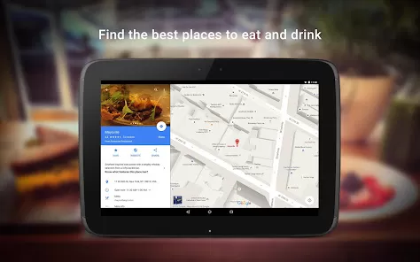
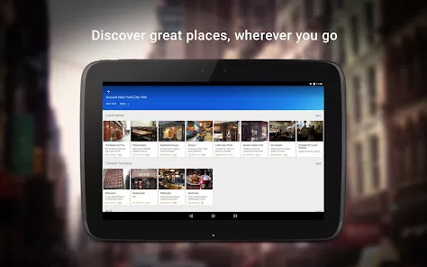
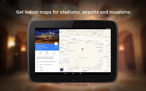
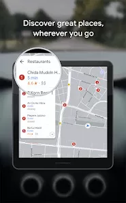
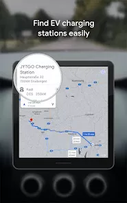
Comprehensive Information: It offers extensive information about millions of locations worldwide, including businesses, restaurants, schools, and points of interest, helping users make informed decisions.
Street View: Google Maps allows users to virtually explore streets and neighborhoods through its Street View feature, providing a 360-degree view of locations.
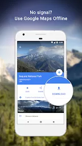
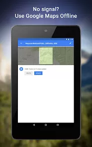
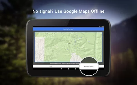
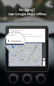
Offline Maps: Users can download maps for offline use, making it easier to navigate in areas with no internet connectivity.
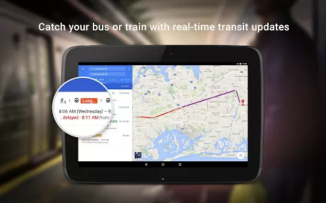
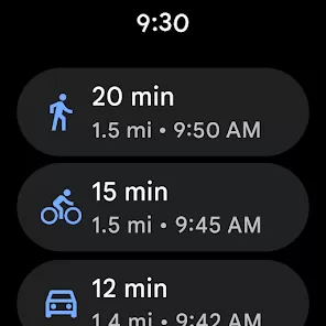
Multi-Mode Navigation: Google Maps supports various modes of transportation, including driving, walking, cycling, and public transit, offering flexible route options for all types of travel.
User Reviews and Ratings: Users can read reviews, ratings, and photos of businesses and locations shared by other users, helping to choose the best places to visit.
Cons of Google Maps
Privacy Concerns: Google Maps collects location data, which may raise privacy concerns for some users who are uncomfortable with their data being tracked or shared.
Battery Drain: Continuous use of GPS navigation on Google Maps can drain the battery of your mobile device, especially during long trips.
Occasional Inaccuracies: While Google Maps is generally accurate, there are occasional errors in routes, directions, or location information, especially in less populated areas.
Data Usage: Google Maps requires a constant internet connection for real-time updates, which may use significant mobile data, particularly when navigating long distances.
Dependence on Internet Connectivity: Features like real-time traffic updates and live navigation require an active internet connection, making it difficult to use in areas with poor or no signal.
Key Features of Google Maps
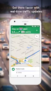
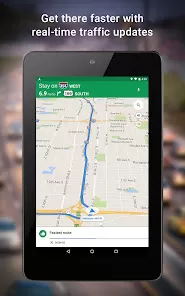
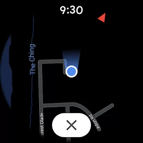
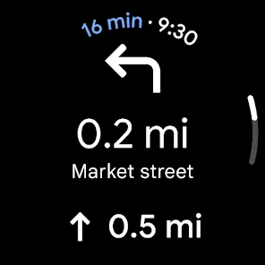
Real-Time Navigation: Provides real-time navigation with turn-by-turn directions, rerouting options, and live traffic updates.
Street View: A feature that lets users explore real-world locations at ground level through 360-degree panoramic images.
Offline Maps: The ability to download maps for offline access, ensuring navigation even in areas with no internet service.
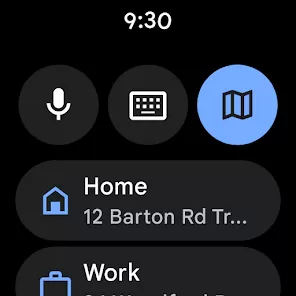
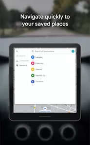
Location Sharing: Users can share their real-time location with friends or family for better coordination.
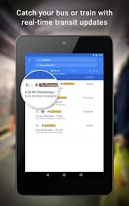
Public Transit Routes: Provides detailed public transportation schedules and directions for buses, trains, and subways in various cities.
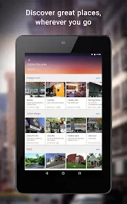
Explore Nearby Places: Google Maps offers recommendations and reviews for nearby restaurants, hotels, shops, and entertainment venues.
Voice Commands: Voice-guided navigation allows hands-free driving and walking, ensuring safety and convenience while on the go.
Functions of Google Maps
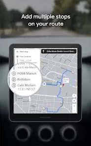
Route Planning: Allows users to plan routes for driving, walking, cycling, or public transit, and provides alternative routes based on real-time traffic conditions.
Traffic Updates: Google Maps tracks live traffic data to provide accurate estimates for arrival times and suggests the fastest route.
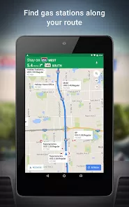
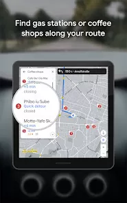
Discover Local Businesses: Users can search for local businesses, read reviews, and find nearby places such as restaurants, banks, gas stations, etc.
Navigation for Multiple Transportation Modes: Google Maps supports navigation for various modes of transportation, making it versatile for different types of travel.
Location History: Users can track their visited places, and view a detailed timeline of their movements, which can be useful for revisiting spots or managing travel memories.
How to Use Google Maps
Click the button "Check All Versions" below to download and install it.
Step 1: Install the App: Download the Google Maps app from the App Store (for iOS) or Google Play Store (for Android). If you are using a desktop, visit the Google Maps website at maps.google.com.
Step 2: Set Up the App: Open the app and sign in with your Google account to personalize your experience. You can customize settings like default transportation mode (car, walking, etc.) and map preferences.
Step 3: Search for Locations: Enter a destination or address in the search bar to view information, routes, and nearby places. You can also search for specific categories like “restaurants” or “gas stations.”
Step 4: Get Directions: Once you've found your destination, tap on "Directions," select your preferred mode of transportation, and Google Maps will provide step-by-step instructions, including alternative routes based on current traffic conditions.
Step 5: Use Street View: To explore a location virtually, drag the yellow Pegman icon on the map to a specific area to activate Street View and see a 360-degree image of that location.
Step 6: Download Offline Maps: To use Google Maps without an internet connection, select your desired map area, and tap on "Download" for offline access. This will enable you to navigate even when your mobile signal is weak or unavailable.
Step 7: Share Your Location: If you want to share your location with others in real-time, tap on the menu and choose "Location Sharing" to send your current whereabouts to friends or family.


 0
0